A client of mine who wanted to find the best location for storage facility was interested in a detailed analysis of US population based on its ethnicity and proximity to commercial stores.
This map involves finding the open source datasets on ArcGIS Online, and using arcade expressions to derive meaningful details about a region.
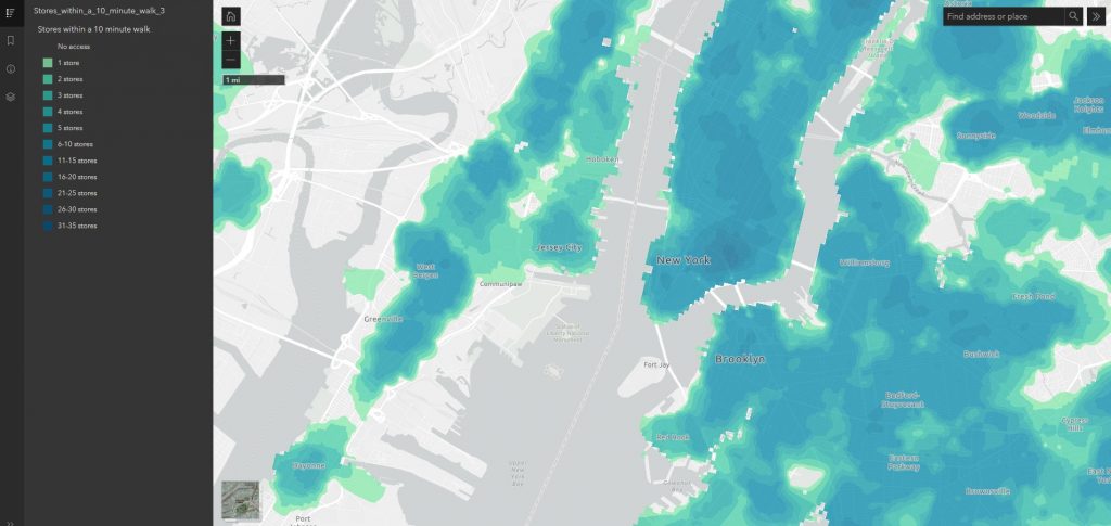
In the above screen capture, we can see a layer that shows how many stores one can reach within a ten minute walk.
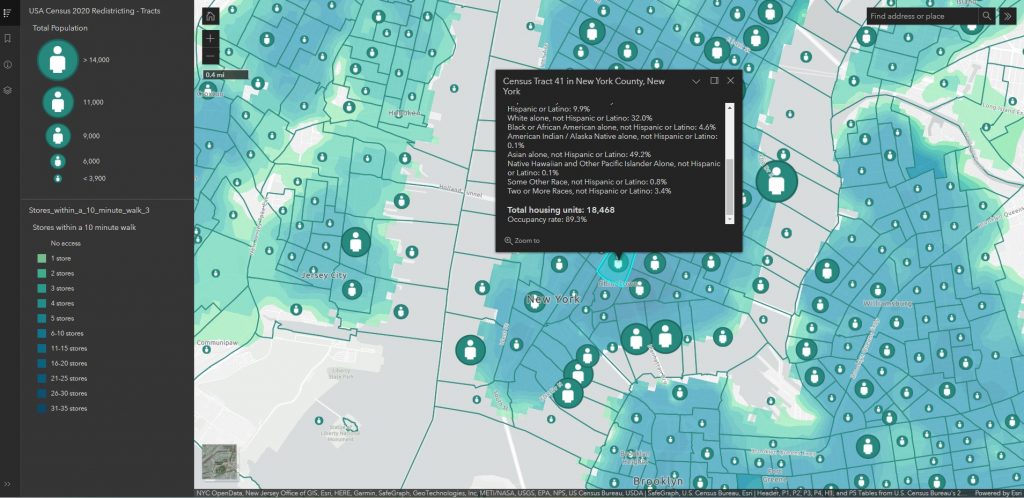
When users zoom in closer, we will be able to see the population layer. It details the population of each tract based on its ethnicity and household units. The analysis was done using arcade expression to generate on the fly calculation.